Home > Europe > United Kingdom > Scotland > West Lothian > Linlithgow
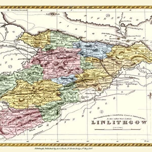
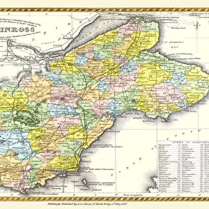
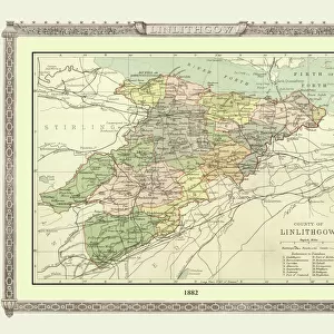
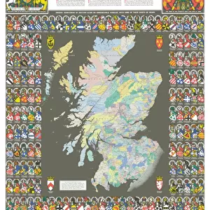
Old Map of the County of Linlithgow from the Philips Handy Atlas of 1882

![]()
Wall Art and Photo Gifts from MapSeeker
Old Map of the County of Linlithgow from the Philips Handy Atlas of 1882
PHA021
Welcome to the Mapseeker Image library and enter an historic gateway to one of the largest on-line collections of Historic Maps, Nostalgic Views, Vista's and Panorama's from a World gone by.
Media ID 20348177
County Map County Map Of Scotland Historic Map Old County Map Old Scottish County Map Scottish County Map Linlithgow Linlithgowshire
FEATURES IN THESE COLLECTIONS
> Europe
> United Kingdom
> Scotland
> Linlithgowshire
> Europe
> United Kingdom
> Scotland
> Lothian
> Linlithgow
> Europe
> United Kingdom
> Scotland
> Maps
> Europe
> United Kingdom
> Scotland
> West Lothian
> Linlithgow
> Maps and Charts
> Early Maps
> Maps and Charts
> Related Images
> MapSeeker
> Maps from the British Isles
> Scotland and Counties PORTFOLIO
EDITORS COMMENTS
This print showcases an exquisite piece of history: the Old Map of the County of Linlithgow from the Philips Handy Atlas of 1882. Steeped in Scottish heritage, this vintage county map offers a fascinating glimpse into the past. With its intricate details and delicate craftsmanship, it transports us to a bygone era. As we explore this old Scottish county map, we are transported back to a time when Linlithgow was at the heart of Scotland's historical tapestry. The map reveals an array of towns, villages, and landmarks that have shaped the region's identity over centuries. From majestic castles to winding rivers and rolling hillsides, each element on this historic Linlithgow map tells a story waiting to be discovered. With its muted color palette and aged appearance, this print exudes nostalgia and charm. It serves as a reminder that maps are not just tools for navigation but also windows into our collective past. Whether you're tracing your ancestral roots or simply appreciating the beauty of cartography, this old county map is sure to captivate any history enthusiast. Preserved with care and presented here as a stunning photographic print by MapSeeker (not affiliated with any commercial use), this Old Map of the County of Linlithgowshire invites us on an enchanting journey through time. Let it transport you back to an era where exploration was marked by inked lines on parchment—a testament to human curiosity and our endless quest for knowledge about our surroundings.
MADE IN THE USA
Safe Shipping with 30 Day Money Back Guarantee
FREE PERSONALISATION*
We are proud to offer a range of customisation features including Personalised Captions, Color Filters and Picture Zoom Tools
SECURE PAYMENTS
We happily accept a wide range of payment options so you can pay for the things you need in the way that is most convenient for you
* Options may vary by product and licensing agreement. Zoomed Pictures can be adjusted in the Cart.