Home > Europe > United Kingdom > England > London > Sights > Richmond Park
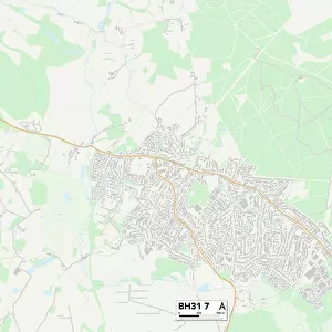
Purbeck BH19 2 Map

![]()
Wall Art and Photo Gifts from Map Marketing
Purbeck BH19 2 Map
Postcode Sector Map of Purbeck BH19 2
Media ID 19965550
Anvil Close Ash Close Atlantic Road Bay View Bell Street Belle Vue Road Belvedere Road Boundary Close Broad Road Cobblers Lane Cow Lane Drummond Road Exeter Road Foxhill Close Grosvenor Road High Street Hillview Road Holmes Road Jubilee Road Kingswood Close Manor Road Marsh Way Newton Road Osborne Road Park Road Peveril Road Purbeck Quarry Close Queens Road Richmond Road Russell Avenue Russell Drive Salisbury Road Shirley Close Solent Road South Road St Catherines Road Stafford Road Sydenham Road Taunton Road Townsend Road West Drive Durlston Swanage
FEATURES IN THESE COLLECTIONS
> Animals
> Farm
> Cattle
> Related Images
> Arts
> Portraits
> Pop art gallery
> Street art portraits
> Europe
> United Kingdom
> England
> Isle of Wight
> Cowes
> Europe
> United Kingdom
> England
> London
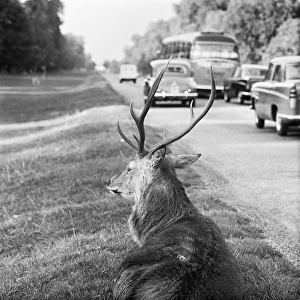
> Sights
> Richmond Park
> Map Marketing
> Postcode Sector Maps
> BH - Bournemouth
> Maps and Charts
> Related Images
MADE IN THE USA
Safe Shipping with 30 Day Money Back Guarantee
FREE PERSONALISATION*
We are proud to offer a range of customisation features including Personalised Captions, Color Filters and Picture Zoom Tools
SECURE PAYMENTS
We happily accept a wide range of payment options so you can pay for the things you need in the way that is most convenient for you
* Options may vary by product and licensing agreement. Zoomed Pictures can be adjusted in the Cart.