Home > Europe > United Kingdom > Scotland > Angus > Forfar
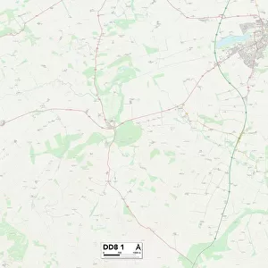
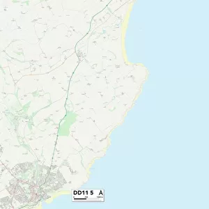
Angus DD8 5 Map

![]()
Wall Art and Photo Gifts from Map Marketing
Angus DD8 5 Map
Postcode Sector Map of Angus DD8 5
Media ID 19968933
Angus Beechwood Crescent Beechwood Place East Bank Forfar Road Glamis Road Henry Street Hobart Street Kirkton Road Lindsay Street Low Road Main Road Manse Lane Mill Street Morrison Street Muir Street Old School Road Roman Road Slade Road South Street Sunnyside Victoria Street West Bank Westfield Airlie The Moon
FEATURES IN THESE COLLECTIONS
> Arts
> Artists
> R
> Roman Roman
> Arts
> Portraits
> Pop art gallery
> Street art portraits
> Europe
> United Kingdom
> Scotland
> Angus
> Forfar
> Europe
> United Kingdom
> Scotland
> West Lothian
> Bridgend
> Europe
> United Kingdom
> Wales
> Mid Glamorgan
> Bridgend
> Map Marketing
> Postcode Sector Maps
> DD - Dundee
> Maps and Charts
> Related Images
MADE IN THE USA
Safe Shipping with 30 Day Money Back Guarantee
FREE PERSONALISATION*
We are proud to offer a range of customisation features including Personalised Captions, Color Filters and Picture Zoom Tools
SECURE PAYMENTS
We happily accept a wide range of payment options so you can pay for the things you need in the way that is most convenient for you
* Options may vary by product and licensing agreement. Zoomed Pictures can be adjusted in the Cart.