Home > Europe > United Kingdom > England > London > Boroughs > Harrow
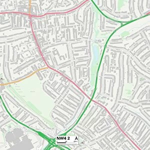
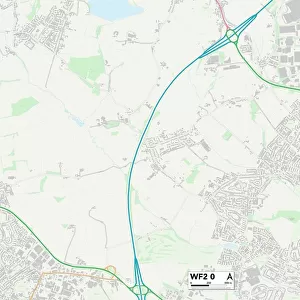
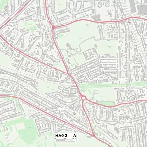
Harrow HA3 9 Map

![]()
Wall Art and Photo Gifts from Map Marketing
Harrow HA3 9 Map
Postcode Sector Map of Harrow HA3 9
Media ID 19970611
Arnold Close Campion Close Chantry Close Charlton Road Clay Lane Clifton Road Court Close Cowbridge Road Cumberland Road Dorchester Way Glebe Avenue Glebe Crescent Glebe Lane Harrow Hillside Gardens Honeypot Lane Imperial Way Kenmore Road Kenton Road Lodge Avenue Magnolia Court Malvern Gardens May Lane Melbury Road Moorhouse Road Morland Road Orchard Grove Page Close Repton Road Robin Grove Rowland Avenue Sandy Lane Shakespeare Drive Shrewsbury Avenue St Pauls Avenue The Garth The Leys The Mall Westfield Drive Westfield Gardens Westfield Lane Winchester Road Queensbury
FEATURES IN THESE COLLECTIONS
> Arts
> Artists
> C
> John Charlton
> Arts
> Artists
> H
> John Hillers
> Arts
> Artists
> H
> John Hills
> Arts
> Artists
> L
> John Lodge
> Arts
> Artists
> R
> John Ruskin
> Europe
> United Kingdom
> England
> Cumberland
> Europe
> United Kingdom
> England
> London
> Boroughs
> Harrow
> Europe
> United Kingdom
> Wales
> South Glamorgan
> Cowbridge
> Map Marketing
> Postcode Sector Maps
> HA - Harrow
> Maps and Charts
> Related Images
MADE IN THE USA
Safe Shipping with 30 Day Money Back Guarantee
FREE PERSONALISATION*
We are proud to offer a range of customisation features including Personalised Captions, Color Filters and Picture Zoom Tools
SECURE PAYMENTS
We happily accept a wide range of payment options so you can pay for the things you need in the way that is most convenient for you
* Options may vary by product and licensing agreement. Zoomed Pictures can be adjusted in the Cart.