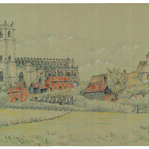
Home > Arts > Artists > B > Charles Brooking
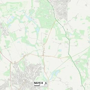
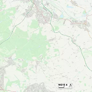
Walsall WS2 9 Map

![]()
Wall Art and Photo Gifts from Map Marketing
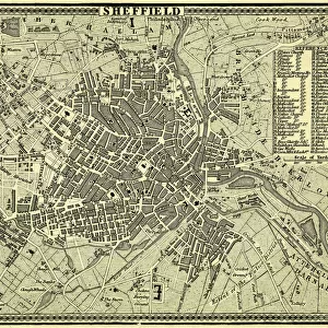
Walsall WS2 9 Map
Postcode Sector Map of Walsall WS2 9
Media ID 19980824
A461 Bassett Street Berkeley Street Brook Street Brunswick Street Cavell Close Charles Street Chester Place Clement Street Durham Place Durham Road Ely Road Ford Street Frederick Street Gower Street Henry Street Horseshoe Close Kingsley Street Long Street Madison Avenue Manor Road Marsh Lane Marsh Street Moat Road Montfort Road Narrow Lane Navigation Street New Mills Norwich Road Oxford Street Prince Street Queen Street Regal Drive Reservoir Close Reservoir Street Ripon Road Rochford Close Scarborough Road Sheridan Close Sheridan Street Short Street Smith Road Somers Road Southbourne Avenue St Johns Road Upper Brook Street Vicarage Terrace Walsall Wellington Street Wharf Street Wilbraham Road Ely Place
FEATURES IN THESE COLLECTIONS
> Arts
> Artists
> B
> Charles Brooking
> Arts
> Artists
> B
> John Brooks
> Arts
> Artists
> C
> James Charles
> Arts
> Artists
> F
> Henry Ford
> Arts
> Artists
> F
> John Ford
> Arts
> Artists
> J
> Augustus John
> Arts
> Artists
> K
> Charles Kingsley
> Arts
> Artists
> P
> Charles Phillips
> Arts
> Artists
> P
> John Phillip
> Arts
> Artists
> S
> Charles John Smith
> Map Marketing
> Postcode Sector Maps
> WS - Walsall
MADE IN THE USA
Safe Shipping with 30 Day Money Back Guarantee
FREE PERSONALISATION*
We are proud to offer a range of customisation features including Personalised Captions, Color Filters and Picture Zoom Tools
SECURE PAYMENTS
We happily accept a wide range of payment options so you can pay for the things you need in the way that is most convenient for you
* Options may vary by product and licensing agreement. Zoomed Pictures can be adjusted in the Cart.