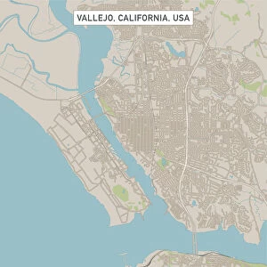
Home > Europe > United Kingdom > Wales > Gwent > Newport
Costa Mesa California US City Street Map

![]()
Wall Art and Photo Gifts from Fine Art Storehouse
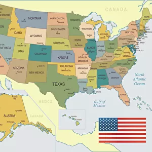
Costa Mesa California US City Street Map
Vector Illustration of a City Street Map of Costa Mesa, California, USA. Scale 1:60, 000.
All source data is in the public domain.
U.S. Geological Survey, US Topo
Used Layers:
USGS The National Map: National Hydrography Dataset (NHD)
USGS The National Map: National Transportation Dataset (NTD)
Unleash your creativity and transform your space into a visual masterpiece!
Frank Ramspott
Media ID 15055073
© Frank Ramspott, all rights reserved
Aerial View California City Map Computer Graphic Directly Above Downtown District Gray Road Map Text Digitally Generated Image Green Color White Color
FEATURES IN THESE COLLECTIONS
> Aerial Photography
> Related Images
> Animals
> Insects
> Hemiptera
> Green Scale
> Animals
> Mammals
> Cricetidae
> California Mouse
> Arts
> Contemporary art
> Digital artwork
> Street art
> Arts
> Landscape paintings
> Waterfall and river artworks
> River artworks
> Arts
> Portraits
> Pop art gallery
> Street art portraits
> Arts
> Street art graffiti
> Digital art
> Digital paintings
> Arts
> Street art graffiti
> Digital art
> Vector illustrations
> Europe
> United Kingdom
> Wales
> Gwent
> Newport
> Europe
> United Kingdom
> Wales
> Pembrokeshire
> Newport
> Fine Art Storehouse
> Map
> Street Maps
> Fine Art Storehouse
> Map
> USA Maps
EDITORS COMMENTS
This print showcases a detailed and meticulously crafted city street map of Costa Mesa, California, USA. With a scale of 1:60,000, every intricate detail is brought to life in this vector illustration. The artist has skillfully utilized various layers from the USGS The National Map to create this stunning piece. The map encompasses the vibrant city of Costa Mesa along with its surrounding areas such as Santa Ana River and Newport Bay. It beautifully captures the essence of this bustling urban landscape, highlighting key landmarks like the downtown district and notable streets. Rendered in an aesthetically pleasing color palette consisting of shades of gray, green, blue, and white; this digitally generated image exudes both elegance and clarity. Its aerial view perspective offers a unique vantage point directly above the cityscape. This artwork is not only visually appealing but also serves as a valuable cartographic resource for residents and visitors alike. Designed by Frank Ramspott using publicly available data from U. S Geological Survey's topographical maps - specifically their National Hydrography Dataset (NHD) and National Transportation Dataset (NTD). Perfectly suited for any space or interior design style, this print adds sophistication while showcasing your love for geography and exploration. Whether you're an avid traveler or simply appreciate fine artistry combined with practicality, this Costa Mesa City Street Map print is sure to captivate all who lay eyes upon it.
MADE IN THE USA
Safe Shipping with 30 Day Money Back Guarantee
FREE PERSONALISATION*
We are proud to offer a range of customisation features including Personalised Captions, Color Filters and Picture Zoom Tools
SECURE PAYMENTS
We happily accept a wide range of payment options so you can pay for the things you need in the way that is most convenient for you
* Options may vary by product and licensing agreement. Zoomed Pictures can be adjusted in the Cart.