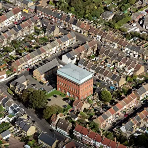
Home > Europe > United Kingdom > England > Kent > Green Street Green
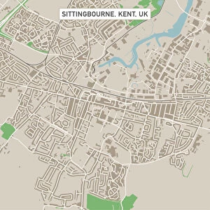
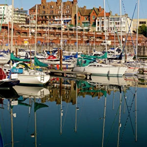
Ramsgate Kent UK City Street Map

![]()
Wall Art and Photo Gifts from Fine Art Storehouse
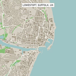
Ramsgate Kent UK City Street Map
Vector Illustration of a City Street Map of Ramsgate, Kent, UK. Included files are EPS (v10) and Hi-Res JPG.
Data courtesy from Ordnance Survey: VectorMap District
https:/ordnancesurvey.co.uk/business-and-government/products/vectormap-district.html
OS OpenData is free to use under the Open Government Licence (OGL).
Contains OS data eCrown copyright and database right 2017.
http:/nationalarchives.gov.uk/doc/open-government-licence/version/3/
Unleash your creativity and transform your space into a visual masterpiece!
Frank Ramspott
Media ID 15055231
© Frank Ramspott, all rights reserved
Aerial View Computer Graphic Directly Above Gray Green Harbor Kent North Sea Road Map Street Map Text Digitally Generated Image Ramsgate
FEATURES IN THESE COLLECTIONS
> Aerial Photography
> Related Images
> Arts
> Contemporary art
> Digital artwork
> Street art
> Arts
> Portraits
> Pop art gallery
> Street art portraits
> Arts
> Street art graffiti
> Digital art
> Digital paintings
> Arts
> Street art graffiti
> Digital art
> Vector illustrations
> Europe
> United Kingdom
> England
> Kent
> Green Street Green
> Europe
> United Kingdom
> England
> Kent
> Kent Street
> Europe
> United Kingdom
> England
> Kent
> North Street
> Europe
> United Kingdom
> England
> Kent
> Ramsgate
> Europe
> United Kingdom
> Maps
> Fine Art Storehouse
> The Great British Seaside
> Ramsgate, The Great English Seaside
> Fine Art Storehouse
> Map
> Street Maps
EDITORS COMMENTS
This print showcases a detailed and vibrant city street map of Ramsgate, Kent, UK. The vector illustration captures the essence of this charming coastal town with its intricate road network, including major streets and buildings. The image is digitally generated, presenting an aerial view from directly above, providing a unique perspective on the city's layout. The map incorporates various colors to distinguish different elements such as roads (gray), green spaces (green), water bodies like the North Sea and harbor (blue), and text labels (white). This combination creates a visually appealing composition that not only serves as a navigational tool but also doubles as an artistic piece. It is worth noting that this impressive artwork was created using data courtesy of Ordnance Survey: VectorMap District. The inclusion of OS OpenData ensures that it can be freely used under the Open Government Licence (OGL) while acknowledging OS data eCrown copyright and database right 2017. Whether you are a resident or visitor to Ramsgate, this stunning print offers both practicality and aesthetic appeal. It would make an ideal addition to any home or office space for those who appreciate cartography, design, or simply want to celebrate their connection to this picturesque seaside town.
MADE IN THE USA
Safe Shipping with 30 Day Money Back Guarantee
FREE PERSONALISATION*
We are proud to offer a range of customisation features including Personalised Captions, Color Filters and Picture Zoom Tools
SECURE PAYMENTS
We happily accept a wide range of payment options so you can pay for the things you need in the way that is most convenient for you
* Options may vary by product and licensing agreement. Zoomed Pictures can be adjusted in the Cart.