Home > Europe > United Kingdom > England > Cleveland
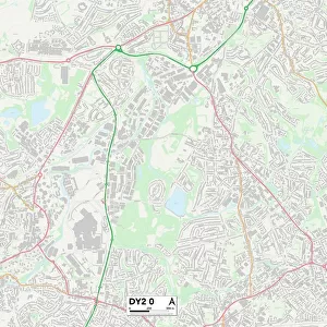
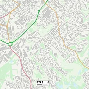
Dudley DY1 1 Map

![]()
Wall Art and Photo Gifts from Map Marketing
Dudley DY1 1 Map
Postcode Sector Map of Dudley DY1 1
Media ID 19969034
Angel Street Castle Street Charlotte Street Charlton Street Cleveland Street Clifford Street Cross Street Dock Lane Dudley Fisher Street Furnace Road High Street Junction Street King Street New Street Oxford Street Priory Street Richmond Road St Jamess Road Stafford Street Stone Street Sycamore Close Tower Street Trinity Road Turner Street Union Street Vauxhall Street Wellington Road Ludgate Street Old Dock Pitfield Street
FEATURES IN THESE COLLECTIONS
> Architecture
> Towers
> Castles
> Arts
> Portraits
> Pop art gallery
> Street art portraits
> Europe
> United Kingdom
> England
> Cleveland
> Map Marketing
> Postcode Sector Maps
> DY - Dudley
> Maps and Charts
> Related Images
MADE IN THE USA
Safe Shipping with 30 Day Money Back Guarantee
FREE PERSONALISATION*
We are proud to offer a range of customisation features including Personalised Captions, Color Filters and Picture Zoom Tools
SECURE PAYMENTS
We happily accept a wide range of payment options so you can pay for the things you need in the way that is most convenient for you
* Options may vary by product and licensing agreement. Zoomed Pictures can be adjusted in the Cart.