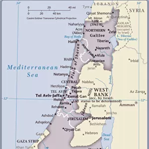
Home > Africa > Egypt > Maps
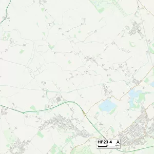
Aylesbury Vale HP19 8 Map

![]()
Wall Art and Photo Gifts from Map Marketing
Aylesbury Vale HP19 8 Map
Postcode Sector Map of Aylesbury Vale HP19 8
Media ID 19972080
Aylesbury Vale Blake Street Broadfields Brunel Road Chamberlain Road Chelsea Road Edison Road Faraday Road Gatehouse Close Goodwin Road Griffin Lane Homestead Way Kingsgate Mill Meadow Millers Way Nelson Terrace Palmer Avenue Phillips Road Pottery Close Roman Way Rubens Close Smeaton Close St Catherines Court St Edmunds Close Telford Close The Serpentine Whitehall Street Windmill Close Leith Road
FEATURES IN THESE COLLECTIONS
> Africa
> Egypt
> Related Images
> Arts
> Artists
> R
> Rembrandt
> Arts
> Artists
> R
> Roman Roman
> Arts
> Portraits
> Pop art gallery
> Street art portraits
> Europe
> United Kingdom
> England
> London
> Boroughs
> Kensington and Chelsea
> Europe
> United Kingdom
> England
> London
> Related Images
> Map Marketing
> Postcode Sector Maps
> HP - Hemel Hempstead
MADE IN THE USA
Safe Shipping with 30 Day Money Back Guarantee
FREE PERSONALISATION*
We are proud to offer a range of customisation features including Personalised Captions, Color Filters and Picture Zoom Tools
SECURE PAYMENTS
We happily accept a wide range of payment options so you can pay for the things you need in the way that is most convenient for you
* Options may vary by product and licensing agreement. Zoomed Pictures can be adjusted in the Cart.