Home > Maps and Charts > Related Images
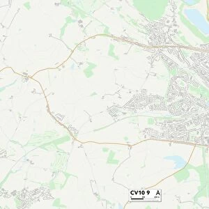
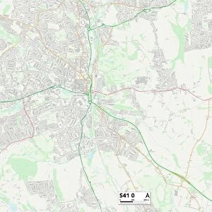
Leicester LE4 2 Map

![]()
Wall Art and Photo Gifts from Map Marketing
Leicester LE4 2 Map
Postcode Sector Map of Leicester LE4 2
Media ID 19973563
Abbey Drive Acer Close Adelaide Close Ashton Close Bevan Road Blenheim Way Bretton Close Croft Road David Avenue Deacon Road Elliott Road Felstead Road Galway Road Garth Avenue Glebelands Road Gresley Close Hadrian Road Hogarth Road Jersey Road Langley Avenue Langley Gardens Lawrence Close Leicester Leicester Road Millbrook Close Morpeth Avenue Orton Road Stapleford Road The Sidings Trent Avenue Wade Street Wheatley Road Woodstock Close Woodstock Road
FEATURES IN THESE COLLECTIONS
> Map Marketing
> Postcode Sector Maps
> LE - Leicester
> Maps and Charts
> Related Images
MADE IN THE USA
Safe Shipping with 30 Day Money Back Guarantee
FREE PERSONALISATION*
We are proud to offer a range of customisation features including Personalised Captions, Color Filters and Picture Zoom Tools
SECURE PAYMENTS
We happily accept a wide range of payment options so you can pay for the things you need in the way that is most convenient for you
* Options may vary by product and licensing agreement. Zoomed Pictures can be adjusted in the Cart.