Home > Arts > Artists > P > Linton Park
North Tyneside NE26 4 Map

![]()
Wall Art and Photo Gifts from Map Marketing
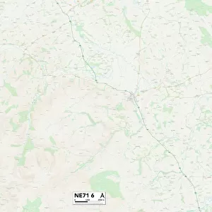
North Tyneside NE26 4 Map
Postcode Sector Map of North Tyneside NE26 4
Media ID 19975446
Albert Road Beresford Road Blyth Road Boundary Way Clarence Street Conway Grove Cresswell Avenue Dereham Road Derwent Road East End Fernbank Granville Avenue Hastings Avenue Links Road Linton Road Malvern Road Meadow Road Millfield Millway North Tyneside Queens Road Seaton The Avenue The Coppice The Crest The Links The Rise Waterford Close West End West Terrace Westlands Southward St Marys Wynd
FEATURES IN THESE COLLECTIONS
> Arts
> Artists
> P
> Linton Park
> Map Marketing
> Postcode Sector Maps
> NE - Newcastle upon Tyne
> Maps and Charts
> Related Images
MADE IN THE USA
Safe Shipping with 30 Day Money Back Guarantee
FREE PERSONALISATION*
We are proud to offer a range of customisation features including Personalised Captions, Color Filters and Picture Zoom Tools
SECURE PAYMENTS
We happily accept a wide range of payment options so you can pay for the things you need in the way that is most convenient for you
* Options may vary by product and licensing agreement. Zoomed Pictures can be adjusted in the Cart.