Home > Europe > United Kingdom > England > London > Sights > Regents Park
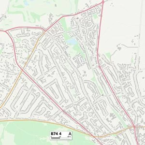
Preston PR2 9 Map

![]()
Wall Art and Photo Gifts from Map Marketing
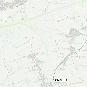
Preston PR2 9 Map
Postcode Sector Map of Preston PR2 9
Media ID 19978238
Almond Close Ashfield Ashwood Road Aysgarth Avenue Azalea Close Broadway Brookfield Drive Brooklands Avenue Brookside Road Castle Mount Caxton Road Cherry Close Chestnut Drive Clement Road Craven Close Eastway Elder Close Eskdale Close Ferndale Garstang Road Goodwood Avenue Green Drive Greenway Hall Road Harrison Road Haywood Close Highfield Drive Hill Crest Avenue Lavender Close Longfield Magnolia Close Marina Drive Meadowfield Middleton Road Moorfield Close Northlands Northway Oakfield Oakridge Close Parklands Drive Preston Princes Drive Queens Drive Raleigh Road Regent Court Royal Avenue Sherwood Way Singleton Close South Drive South Grove Southey Close Spruce Close St Francis Close Sycamore Close The Brambles The Briars The Turnpike The Warren Tiverton Close Tower Lane Waterford Close Windsor Drive Woodlands Drive Fulwood Hellifield Tower Green
FEATURES IN THESE COLLECTIONS
> Animals
> Birds
> Passerines
> Finches
> Brambling
> Architecture
> Towers
> Castles
> Arts
> Artists
> P
> Francis Place
> Europe
> United Kingdom
> England
> London
> Sights
> Regents Park
> Europe
> United Kingdom
> Scotland
> Fife
> Ladybank
> Europe
> United Kingdom
> Scotland
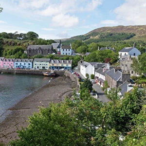
> Highlands
> Portree
> Europe
> United Kingdom
> Scotland
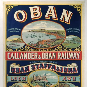
> Stirlingshire
> Callander
> Europe
> United Kingdom
> Wales
> Flintshire
> Broughton
> Map Marketing
> Postcode Sector Maps
> PR - Preston
MADE IN THE USA
Safe Shipping with 30 Day Money Back Guarantee
FREE PERSONALISATION*
We are proud to offer a range of customisation features including Personalised Captions, Color Filters and Picture Zoom Tools
SECURE PAYMENTS
We happily accept a wide range of payment options so you can pay for the things you need in the way that is most convenient for you
* Options may vary by product and licensing agreement. Zoomed Pictures can be adjusted in the Cart.