Home > Arts > Artists > O > Elizabeth Olds
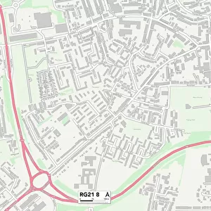
Berkshire RG17 9 Map

![]()
Wall Art and Photo Gifts from Map Marketing
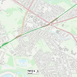
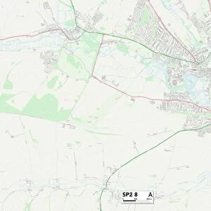
Berkshire RG17 9 Map
Postcode Sector Map of Berkshire RG17 9
Media ID 19980528
Back Lane Barn Close Bell Lane Berkshire Bradley Close Church Lane Church Street Craven Close Craven Road Elizabeth Gardens Folly Road Forge Close Gainsborough Avenue Gladstone Close Harold Road High Street Holt Road Hungerford Road Kennet Road Long Close Lower Green Mill Bank Newbury Street Post Office Road Pottery Lane Queens Way Station Road The Croft The Drove The Firs The Green The Haven Upper Green Weavers Lane Clapton Combe
FEATURES IN THESE COLLECTIONS
> Arts
> Artists
> O
> Elizabeth Olds
> Europe
> Republic of Ireland
> Maps
> Europe
> United Kingdom
> England
> Berkshire
> Combe
> Europe
> United Kingdom
> England
> Berkshire
> The Holt
> Europe
> United Kingdom
> England
> Berkshire
> Hungerford
> Europe
> United Kingdom
> England
> Berkshire
> Inkpen
> Europe
> United Kingdom
> England
> Berkshire
> Kennet
> Europe
> United Kingdom
> England
> Berkshire
> Lower Green
> Europe
> United Kingdom
> England
> Berkshire
> Newbury
> Europe
> United Kingdom
> England
> Berkshire
> Related Images
> Map Marketing
> Postcode Sector Maps
> RG - Reading
MADE IN THE USA
Safe Shipping with 30 Day Money Back Guarantee
FREE PERSONALISATION*
We are proud to offer a range of customisation features including Personalised Captions, Color Filters and Picture Zoom Tools
SECURE PAYMENTS
We happily accept a wide range of payment options so you can pay for the things you need in the way that is most convenient for you
* Options may vary by product and licensing agreement. Zoomed Pictures can be adjusted in the Cart.