Home > Europe > United Kingdom > England > Essex > Linton
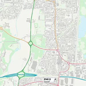
Broxbourne EN11 0 Map

![]()
Wall Art and Photo Gifts from Map Marketing
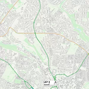
Broxbourne EN11 0 Map
Postcode Sector Map of Broxbourne EN11 0
Media ID 19969636
Alder Close Avenue Road Bingley Road Blythe Road Castle Close Castle Road Cecil Road Century Road Chestnut Grove Clyde Road Cranborne Road Crossfield Road Derby Road Duke Street Eldon Road Essex Road Essex Way Farm Lane Field Way Foxglove Close Gladstone Road Hawthorn Road Ivy Terrace Laburnum Road Lea Road Lilac Road Manor Road Marston Road Normandy Way Oliver Close Plumpton Road Rye Road Salisbury Road St Cuthberts Road St Martins Road Stanstead Road Stephenson Close Village Close Walton Road Whitley Road Broxbourne Rye House
FEATURES IN THESE COLLECTIONS
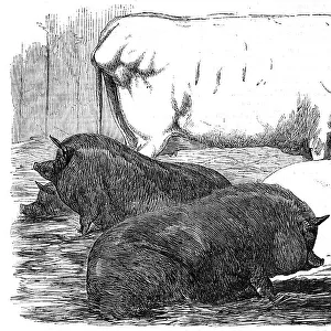
> Animals
> Mammals
> Muridae
> House Mouse
> Arts
> Artists
> P
> Linton Park
> Arts
> Landscape paintings
> Waterfall and river artworks
> River artworks
> Arts
> Portraits
> Pop art gallery
> Street art portraits
> Europe
> United Kingdom
> England
> Essex
> Linton
> Europe
> United Kingdom
> England
> Essex
> Related Images
> Europe
> United Kingdom
> England
> Essex
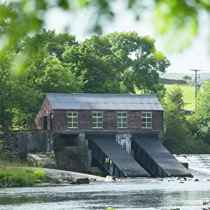
> Weir
> Map Marketing
> Postcode Sector Maps
> EN - Enfield
> Map Marketing
> UK Maps
> Maps and Charts
> Related Images
> North America
> Saint Martin
> Maps
> Posters
> Movie Posters
> Laburnum Grove
MADE IN THE USA
Safe Shipping with 30 Day Money Back Guarantee
FREE PERSONALISATION*
We are proud to offer a range of customisation features including Personalised Captions, Color Filters and Picture Zoom Tools
SECURE PAYMENTS
We happily accept a wide range of payment options so you can pay for the things you need in the way that is most convenient for you
* Options may vary by product and licensing agreement. Zoomed Pictures can be adjusted in the Cart.