Home > Europe > United Kingdom > England > Staffordshire > Norbury
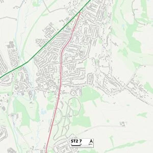
Staffordshire ST2 7 Map

![]()
Wall Art and Photo Gifts from Map Marketing
Staffordshire ST2 7 Map
Postcode Sector Map of Staffordshire ST2 7
Media ID 19978780
Abbey Drive Adams Street Amelia Close Brookfield Road Celandine Close Chapel Drive Church Avenue Clive Avenue Cope Street Cotswold Crescent Cranborne Avenue Easedale Close Field Avenue Flash Lane Hardman Street Haslemere Avenue Heather Drive Hill View Hillside Close Hillside Road Lambourne Drive Langham Road Leonard Avenue Lockwood Street Meadow Street Millers Lane Milton Norbury Avenue North Drive Norton Street Pembroke Road Red Lane Royal Close Royal Way Sandy Lane Shakespeare Close South Drive Spout Lane Staffordshire Stanley Grove Stoneycroft Woodland View Woodside Place Yew Tree Close
FEATURES IN THESE COLLECTIONS
> Europe
> United Kingdom
> England
> Staffordshire
> Bagnall
> Europe
> United Kingdom
> England
> Staffordshire
> Field
> Europe
> United Kingdom
> England
> Staffordshire
> Flash
> Europe
> United Kingdom
> England
> Staffordshire
> Gayton
> Europe
> United Kingdom
> England
> Staffordshire
> Lane Green
> Europe
> United Kingdom
> England
> Staffordshire
> Norbury
> Europe
> United Kingdom
> England
> Staffordshire
> Red Street
> Europe
> United Kingdom
> England
> Staffordshire
> Related Images
> Europe
> United Kingdom
> England
> Staffordshire
> Stanley
> Europe
> United Kingdom
> England
> Staffordshire
> Stoke on Trent
> Map Marketing
> Postcode Sector Maps
> ST - Stoke-on-Trent
MADE IN THE USA
Safe Shipping with 30 Day Money Back Guarantee
FREE PERSONALISATION*
We are proud to offer a range of customisation features including Personalised Captions, Color Filters and Picture Zoom Tools
SECURE PAYMENTS
We happily accept a wide range of payment options so you can pay for the things you need in the way that is most convenient for you
* Options may vary by product and licensing agreement. Zoomed Pictures can be adjusted in the Cart.