Home > Europe > United Kingdom > England > Rutland > Oakham
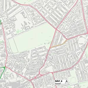
Daventry NN3 7 Map

![]()
Wall Art and Photo Gifts from Map Marketing
Daventry NN3 7 Map
Postcode Sector Map of Daventry NN3 7
Media ID 19975916
Ashby Court Ashley Lane Boughton Road Browns Close Carey Close Carr Road Church Hill Church Street Church View Court Farm Close Cross Street Daventry Earls Close Forester Road Fuller Road Greenwood Close Hallam Close High Street Homestead Close Kettering Road Kirk Close Lavender Hill Manning Road Manor Road Nightingale Drive Oakham Close Oakley Drive Overstone Road Park View Park View Close Pound Lane Russell Square Ryland Road School Lane Spinney Close Spring Close St Nicholas Drive Stanton Close Stewart Close Stocks Hill The Avenue The Crescent The Furrows The Glebe The Grove The Hollies The Laurels The Paddocks Thompson Way Turnpike Wagtail Close Wells Court West Street Moulton
FEATURES IN THESE COLLECTIONS
> Animals
> Birds
> Columbiformes
> Doves
> Related Images
> Animals
> Birds
> Passerines
> Chats And Flycatchers
> Nightingale
> Animals
> Birds
> Passerines
> Wagtails And Pipits
> Related Images
> Animals
> Fishes
> W
> Whiting
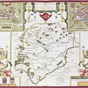
> Europe
> United Kingdom
> England
> Rutland
> Oakham
> Europe
> United Kingdom
> England
> Rutland
> Related Images
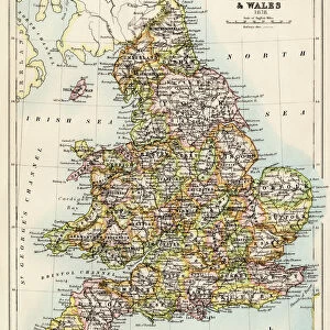
> Europe
> United Kingdom
> Wales
> Maps
> Europe
> United Kingdom
> Wales
> Posters
> Europe
> United Kingdom
> Wales
> Related Images
> Map Marketing
> Postcode Sector Maps
> NN - Northampton
> Maps and Charts
> Related Images
MADE IN THE USA
Safe Shipping with 30 Day Money Back Guarantee
FREE PERSONALISATION*
We are proud to offer a range of customisation features including Personalised Captions, Color Filters and Picture Zoom Tools
SECURE PAYMENTS
We happily accept a wide range of payment options so you can pay for the things you need in the way that is most convenient for you
* Options may vary by product and licensing agreement. Zoomed Pictures can be adjusted in the Cart.