Home > Animals > Farm > Cattle > Related Images
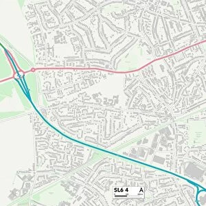
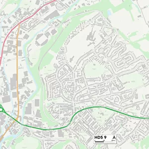
Kirklees HD5 9 Map

![]()
Wall Art and Photo Gifts from Map Marketing
Kirklees HD5 9 Map
Postcode Sector Map of Kirklees HD5 9
Media ID 19971276
Alton Avenue Arlington Way Briggate Broad Lane Brook Street Brooklyn Avenue Buttermere Drive Chapel Lane Church Lane Church Street Coniston Avenue Dalton Dalton Grove Derwent Drive Dyson Street Edgeware Road Eton Avenue First Avenue Greenside Grosvenor Road Grove Place Hill Top Road Ivy Street Kelvin Avenue Kings Mill Lane Kingston Avenue Kirklees Kirkstone Avenue Lady Lane Langdale Drive Lincoln Court Long Lane Longfield Avenue Longfield Close Maple Street Marlow Close Mayfield Avenue Mayfield Grove Melrose Close Mill Avenue Mount Pleasant Street Mulberry Street Nether Close Nettleton Road Patterdale Drive Poplar Street Redwood Grove Ridgeway Ridgeway Close Rydal Drive Second Avenue Silver Street Smithy Lane St James Way Sunnymead Sutton Avenue The Grange West Place Westfield Court Windsor Drive Wood Street
FEATURES IN THESE COLLECTIONS
> Animals
> Farm
> Cattle
> Related Images
> Animals
> Insects
> Spiders
> Silver Garden
> Arts
> Artists
> W
> James Wood
> Europe
> United Kingdom
> England
> Hampshire
> Alton
> Europe
> United Kingdom
> England
> Hampshire
> Bank
> Europe
> United Kingdom
> England
> Hampshire
> Bradley
> Europe
> United Kingdom
> England
> Hampshire
> Brook
> Europe
> United Kingdom
> England
> Hampshire
> Hill Head
> Europe
> United Kingdom
> England
> Hampshire
> Hill Top
> Map Marketing
> Postcode Sector Maps
> HD - Huddersfield
MADE IN THE USA
Safe Shipping with 30 Day Money Back Guarantee
FREE PERSONALISATION*
We are proud to offer a range of customisation features including Personalised Captions, Color Filters and Picture Zoom Tools
SECURE PAYMENTS
We happily accept a wide range of payment options so you can pay for the things you need in the way that is most convenient for you
* Options may vary by product and licensing agreement. Zoomed Pictures can be adjusted in the Cart.